Saturday, November 18, 2023

Chilling out in Bolivia

 Peru was hectic with lots to see and lots of distance to drive; it is a very large country.  Our first week in Bolivia was the the the opposite of most of our time in Peru, it was like a vacation from this road trip.  In this blog we enter Bolivia and spend some time in the resort city of Copacabana before heading the the culturally important and strikingly beautiful Isla del Sol.  After relaxing on the island we decided to relax at a low(er) elevation and try our hand at mountain biking.  We thought it best to go on an "easy" mountain bike route so we tackled the famous Bolivian Death Road.

October 20th – Goodbye Peru


Like all border days we woke up a little stressed.  Border days are unpredictable and we are always unsure if something will arise that will prevent our entrance into the next country.  Today we had real concerns over Rupert as we opted to not prepare any paperwork for him as everyone who had crossed in the last year or two was not asked for documentation.  This is a significant cost savings but if they do ask us, and we don’t have it, it may mean returning to Puno and spending a couple days getting the paperwork complete.  It’s a gamble but we were pretty sure Rupert, and by extension we, would be let in.

It rained almost our entire drive to the Bolivian border.  We only stopped to fill up our tank of gas as getting gas in Bolivia can be tricky (I’m sure we will explain[complain] all about this when we need to purchase gas in a week or so).  This also gave us the opportunity to spend our remaining Peruvian currency.

We choose a small touristy border with Bolivia that typically consists of bus dropping people off, where they complete their immigration and customs paperwork before catching a different bus to the resort community of Copacabana, Bolivia.  Very few vehicles cross this border meaning for those with vehicles the process involves checks and balances as well as police opening and closing defined barricades.

At the border... will we make it though?

Checking out of Peru should be easy, normally it involves going to the immigration person getting an exit stamp then submitting our temporary import permit for the vehicle to the customs officer, all of which takes at most 30 minutes.  However, we knew this would take a bit longer when we arrived to the border and the police officer there wanted us to present him with all our safety gear specifically a high visibility vest, an emergency safety triangle and a fire extinguisher.  We knew that this is a well known shakedown for bribes in Peru so we had purchased all this equipment previously.  After seeing all the equipment, the police then wanted to see our ”botica” (medicine cabinet) and inspect all of that.  We are unsure what would have happened if he had found something but thankfully everything he asked for we could produce.  Slightly more frustrating is the fact that international vehicles are immune to the laws associated with this safety equipment (unless it is required by law in the country the vehicle is registered in)as per Geneva Convention on the Temporary Importation of Private Road Vehicles (this is the international law that allows all vehicles from 99% of countries to drive, temporarily, in the other 99% of countries through a defined process and how we have been legally able to drive from Canada to South America).

The process with Immigration and Customs was everything we expected it to be and went as fast as we would have assumed, with one hiccup.  There seemed to be some confusion when Paul tried to leave Peru as the immigration officer could only find his land border stamp not his stamp from Lima airport.  There was more confusion for Paul as he knew and assumed the immigration officer would know that Lima airport doesn’t stamp passports anymore and being that many backpackers who fly into Lima use this border there was no way he hadn’t encountered this before.  We are sure this was not another potential shakedown but it did require Paul to do a lot more explanation than he thought necessary.  While Paul was dealing with officially exiting Peru Kendra dealt with the van paperwork, which was fairly simple. She found the Aduana trailer beside the burned out Aduana building and got the exit stamp on the permit, she and the van along with Rupert were officially out of Peru while they waited for Paul. The reason the Aduana/customs building was burned was due to protests in January of this year. We encountered many toll booths and a few government offices that were attacked by the local protesters in southern Peru.

We made it!!!
Once we entered no mans land and walked into Bolivia the Bolivian immigration was a breeze, we walked into the immigration office the border guard asked for our passports, which he promptly stamped then directed us out of the building.  No questions, no paperwork, nothing.  Customs took a little longer but it wasn’t stressful, thanks to the demeanor of the customs officer. The customs woman needed to find where the VIN was stamped on the body of our vehicle and when Paul said it wasn’t stamped anywhere (we only knew of it on our windshield which was damaged and illegible thanks to the dealership we bought the vehicle from, and on a sticker on the door) she said that that was fine but she wanted to do her own due diligence.  After looking at many youtube videos and schematics she informed Paul that it was stamped under a panel near the passenger sliding door.  Much to our surprise she was right and after a few more moments we were officially and legally driving in Bolivia.  We wish we had known this previously as our illegible VIN on our windshield always creates a few questions at all the borders.

For those wondering about Rupert, just as we had read no one cared that he was there nor did they ask for any paperwork for him!  The person responsible for asking about the dog’s paperwork is the person searching for the VIN on the van and she didn’t say anything, even though seeing him multiple times.

After being in Peru for 2 months it was surreal to arrive in Bolivia.  Within a couple hours of driving around Copacabana we had the Bolivian currency in our hand, a currency we had never seen before, we had a new SIM card so we could use our phone in the country and we had vegetables, meat and cheese from the market.  By 2pm we had found a campground near the shore of Lake Titicaca and decided to do what we always wanted to do on a border day, relax.   We had successfully crossed into Bolivia and completed all required day 1 tasks so we knew it was time to celebrate.


 October 21st – Drinks with a view

One of the most popular things to do in Copacabana is visit the Island of the Sun (Isla del Sol) the location where the sun was born in some pre-Hispanic cultures as well as hike to and or relax on various beaches.  As we are approaching the rainy season here the weather is a bit too cold for a beach day so we had originally thought to grab a boat to the Island of the Sun.

After a bit of research, we learned that the boat left every morning at 8:30am would return around 3pm and each crossing would take up to 2 hours.  No matter how we looked at it, if felt to do the Island of the Sun properly we needed to spend the night.  Thankfully we learned the boat to the island and everything on the island was dog friendly.  This issue we had is that we had a day or so worth of meat that would spoil if left in our van.  We also only had 30 minutes to pack to leave to the island so we decided to head there tomorrow.

After a filling breakfast we started walking to Copacabana where we realized that the community was far busier than the day we had arrived. As it was Saturday the community was starting to buzz with bus upon bus of Bolivians from La Paz coming to the Copacabana for a night away mixing with the already quasi large backpacker community.  There were numerous event centres as we walked into the community each of which seemed to be preparing for some sort of get together, at least one being a wedding.  The community itself was colourful and felt like a typical Peruvian town, in Bolivia, that invested in beautification.  Buildings were different colours and there was clear signage of where to go and how to get there.  After a bit of wandering we decided that what we would enjoy most was hiking up to a mirador that overlooked the lake as well as the community.


Saturday means Fireworks!!
The hike up was fine, steep in many spots but very popular with families.  There seemed to be numerous religious rituals occurring at different points of the hike with one group setting off firecrackers and pouring beer onto the ground while others would stop at some of the stations of the cross enroute and say a little prayer, potentially for the will power to hike to the top of the mirador (the hike started at the lake level which is 3800 meters above sea level).  Eventually we made it to the top and the view was definitely worth it.  There were even people selling beer at the mirador so we decided to splurge and buy a bottle and spend an hour enjoy the view.

We explored the other streets of Copacabana and by 3pm we were ready to head back to the van.  By the time we had returned a few other overlanders had set up camp where we were staying as well so before we knew it we were saying hello, swapping stories before we did some packing to prepare for our journey to the island.


October 22nd – Tranquilo


We woke up this morning excited to make our way towards Isla del Sol. The walk to the dock took us about 20 minutes and the whole time we became more and more happy that we camped outside of the community.  The wedding and events had gone late with some attendees still sharing bottles sitting on the lake shore, all of which seemed very happy to see Rupert. 
The stairs to the community

We were a little unsure how our boat trip to the island would go, we assumed it would be similar to boarding a boat in the Galapagos where we had to line up then get our ticket checked.  This was not that.  Maybe it was because the morning boat was almost empty due to many people overdoing it the night before but it was a very calm process where the boat Capitan asked people to make their way to the boat, they turned a few of us away to get a new ticket since there were only enough people to run 1 boat instead of two, they took our ticket as we entered and found a seat.  Immediately Rupert was getting a lot of attention especially from kids who wanted to pet him, he definitely became the talk of the boat with many people curious about him and our journey here.


This is what we image a
Greek Island would look like

Before we knew it we arrived at Isla del Sol (Sun Island) and made our way to our hotel where we met an Australian couple.  We seemed to get along really well and before we knew it we had plans for drinks on the patio of the hotel we were all staying at and dinner plans together.

We separated ways so that we could each explore the southern half of the island where we decided to check out the community of Yumani before hiking up to the 2nd tallest peak on the island where we once again relaxed for an hour watching the day go by.  Finally we hiked down to the Sun Temple which was a temple honouring the birthplace of the sun which is said to be on the island.  It was an amazingly preserved temple with multiple rooms with some areas being 3 stories tall with each of the lower rooms being built in a way to allow sun to enter.  It was definitely worth a visit.

By the time we had finished exploring the temple we were starving and thankfully there was a little restaurant near the temple that sold one thing, fresh fish fried.  It was so fun to watch the kids of the owner of the restaurant excitedly run to the lake where they were holding 20 or so trout try to catch our fish.  They generally seemed to see it as a game or challenge of who could get the fish the fastest. After 15 minutes we had hot fried trout in front of us and as you may guess the fish was amazing.

Fresh, fried fish!
The kids were so excited to
catch the fish

The hike back to the hotel was long and uphill but we were greeted by our Australian friends on our return and our promised patio drinks.  Before we knew it we were walking up to the a well rated restaurant located at a mirador where we purchase a few bottles of wine, watched sunset and talked and laughed until it was pitch black and the other patrons of the restaurant had all but left.  It seemed for us to be a perfect day.


October 23rd – Trans-island trail

Isla del Sol is separated into two separate sections, a north section and a south section. Each of which have their own communities and culture and most interestingly these communities do not get along meaning for years at a time it is impossible to travel from the south to the north or vice versa and foreigners not being allowed to visit the north side of the island.  Lucky for us the intercommunity fighting has stopped for the last 8 months meaning we could visit the north side of the island. 

The North Island Labyrinth Ruins
What some visitors to the island do is walked from the South to the North and back which takes roughly 7-8 hours and consists of 20 kilometers.  Not only did we feel this was too much walking for Rupert but this was too much walking for us.  Luckily our friends suggested that we all take a private boat from the south of the island to the north of the island then walk back after seeing the historical sites in the area.  This seemed like a great idea so before we knew it we were on a private boat with another Australian couple who were hoping to do the same thing as us and traveling to the community of Challapampa. 


Lake Titicaca means Puma Rock in
the local language, this rock is THE Puma Rock the lake is named after


Look closely, the "pizza" face is
the face of the sun god
.

The northern part of the island was definitely different from the southern part.  The topography was filled with white rocks and cliffs and many white sand beaches.  If the water was warmer we think we would have actually spent some time enjoying the beach.  Instead, we went to Chincana labyrinth of rooms and buildings all overlooking the water.  Not a lot is known about Chincana but it was a very interesting place to explore.  Just south of the site we found the sacred rock which the indigenous people believe looks like a Puma, we struggled to see it, but it is what Lake Titicaca is named after, Titi mean Puma and Caca means rock therefore Puma Rock in the local Guarani language.  Beside the rock is also the god of the sun which to us looked like a piece of pizza with a face on it and a stone table where llamas were sacrificed.

Crossing the Island

After a lot of exploring, it was time to walk the trans-island trail back to the southern part of the island.  Although the trail was long it was beautiful and we enjoyed delicious sandwiches halfway through our journey thanks to a local indigenous woman who was overjoyed that we were wanting to purchase so much food and drinks (because there were 6 of us).  As Paul spoke the most Spanish in the group he communicated with her the most and it was amazing how much she kept on thanking Paul personally for encouraging the group to stop for drinks and sandwiches even though everyone was quite hungry and thirsty at this point, so it wasn’t hard to convince everyone.

By the time we arrived back at the south island we were exhausted, mostly because of the sun and altitude, but we promised to all meet up again for dinner.  A few hours later we repeated our last night and enjoyed a great meal again, but this time with an additional couple.  It was a sad realization when we finally left the restaurant and said goodbye to all our new friends.  We knew we would be return to the van tomorrow and didn’t know how long it would be until we would have such positive social experiences for such a long period of time again.


October 24th – One final hike

There was one viewpoint that Kendra wanted to see before leaving the island, but since the boat to Copacabana left at 10:30 am we had to wake up early to do it.  It wasn’t clear how to get to the viewpoint, which was located at an abandoned house or hotel (we never were able to find out for certain).  In the end we guessed we had taken the wrong turn meaning we had to hike straight up a mountain through terraces of grazing sheep and llamas before finally getting to the building.  The viewpoint, marked by an old building offered 360 degree views of the island and was definitely worth the sweat to get there.

There are no vehicles on the island,
this is how goods are transported


The boat ride back to Copacabana was less enjoyable then our trip to the island, but this was because so many people were returning with us back to the mainland.  Rupert, as always, made a friend and ate enough treats to the point we didn’t think he needed lunch.  When we did return to the island we split up as we knew Rupert would take a long time to walk the couple kilometers back to the campground and we needed to gather a few supplies for the next few days (food, water, money, etc.).

Although we debated leaving Copacabana we decided to stay instead and get an early start tomorrow.  We had made friends at the campground and wanted to share our insights about Peru with a few of the campers.  Many overlanders do not have positive memories of Peru and have been quite negative about there experiences in the country and although it is not our favourite country on this trip we were able to share our experiences and excitement for those going north.


October 25th – Ferrying the van across Lake Titicaca

Although we did a lot of relaxing in the Copacabana area we decided to continue relaxing in the community of Coroico known for its love of hammocking.  We knew today was going to be a long day of driving (at least 5.5 hours) so we said goodbye to everyone we met in Copacabana and started our drive east.

Many overlanders have had issues when trying to cross Lake Titicaca via the ferry system but we had no issue, in fact we were charged the correct amount with most overlanders staying they were charged an extra 20 Bs ($4 CAD).  The ferries themselves can only hold two vehicles and definitely don’t instill a sense of safety but they did the job and got us across the lake.


Only two vehicles per ferry,
no passenger allowed on buses
The remainder of the day was spent driving, we only stopped to cook some Kraft Dinner for Lunch, however by later afternoon we arrived in Coroico.  We did a lap around town to hopefully find a laundromat but couldn’t find a thing.  It was also a town we realized we didn’t want to drive in, there was no parking and every speedbump scraped the bottom of the van to the point we were worried it would damage a part of our exhaust.  Our campground was perfect for our needs, and best yet it even had a pool.  The temperate climate of the community was such a nice change from what we had been used to in the last few weeks that Paul couldn’t wait to jump into the pool and take full advantage of the warm weather.

It did cool down at night but not enough to prevent us from enjoying the evening outside of our van under our awning meaning we spent the night enjoy the evening warmth while playing some games.


October 26th – The most dangerous road in the world

Although Coroico is known for rest and relaxation there is one tour that has nothing to do with it, mountain biking the most dangerous road in the world.  The most dangerous road in the world, also known as the Death Road or the North Yungas Road which used to cause up to 300 drivers to fall off its cliffs each year resulting in almost 100 deaths a year.  Thankfully a new road was built and now unofficially the route is only used by mountain bikers, although some cars choose to still drive the road much to the annoyance of tour companies. 

A long way down if
you're too careless

Although nervous as we haven’t done a lot of mountain biking we met our tour operator a man named Milo who loaded our bikes and safety gear into a van and drove us up to the top of the death road.  Most tourists will do the tour from La Paz but Milo has a lot of issue with these tours as they tend to be full of tourists (sometimes over 16) with minimal experience on any form of bike and only one guide.   This lack of regulation has resulted in, on average one cyclist a year dying.  Milo assured us that his tour is maximum 3 people with the tour van following behind us for safety. 

The tour was great and although our view was not as great as some others may  experience due to wildfires in the north of the country we had a great time.  We also lucked out by doing our tour from Coroico as we got to the death road first before all other tourists from La Paz so we had the road to ourselves and were not competing with other cyclists.  Even Rupert got to do the death road as we had mentioned we had a dog when we booked the tour and Milo allowed us to keep Rupert in the van following us since it would be unsafe to leave Rupert in our own van due to the mid day sun where it reaches above 30 degrees.

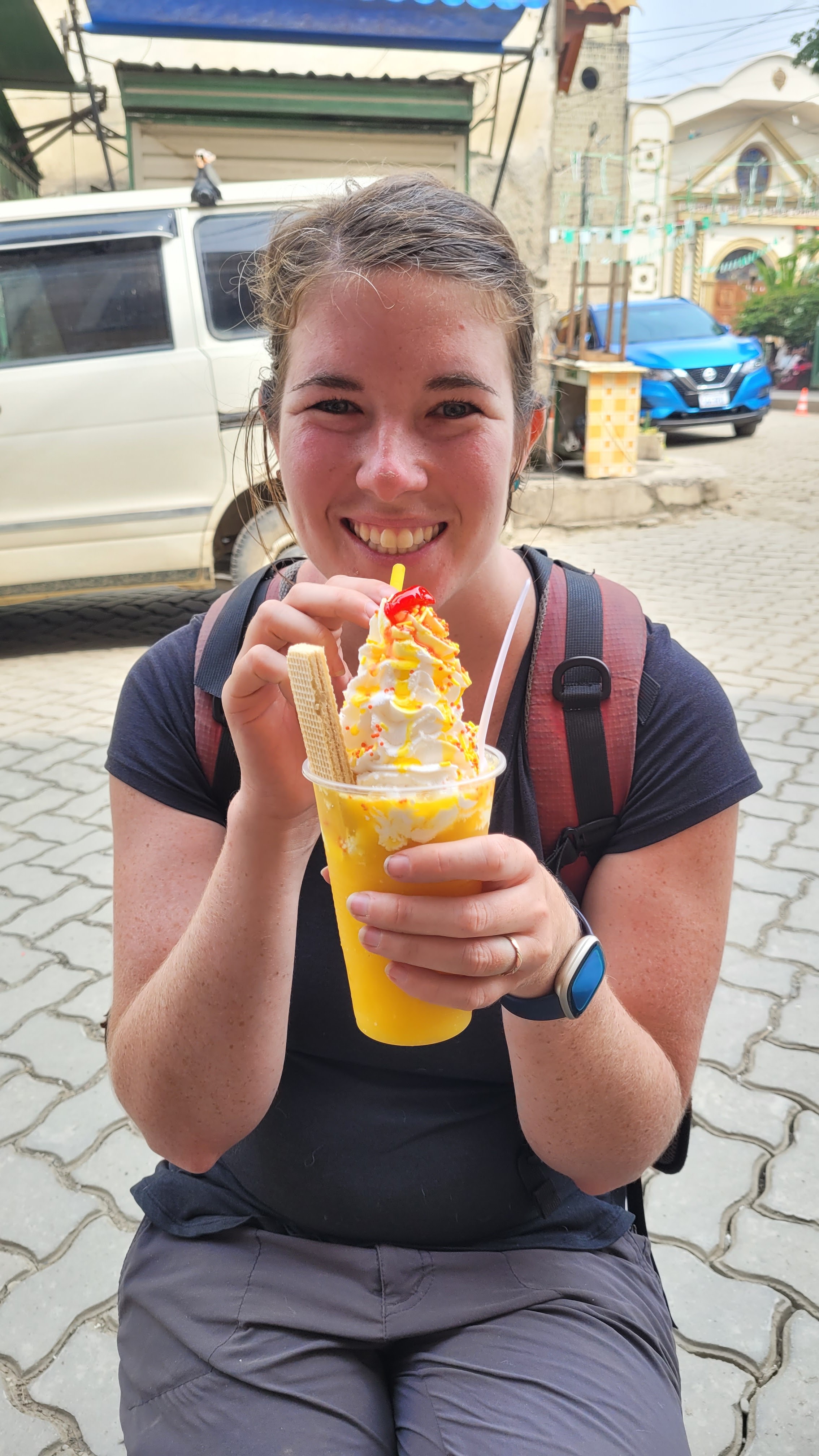
Celebratory ice cream

Kendra getting a lift

After such an adventurous tour we celebrated with ice cream before returning to the campground to relax by the pool and lounge in the hammock.  All in all it was a great day!


Even Rupert enjoyed the
Hammocks
October 27th – A nothing day

After so much hiking and exploring over the last few weeks we had planned to spend the day around the pool reading and relaxing however the weather had other plans.  Instead of the warm sunny weather we had seen for the past day and a half in Coroico it rained, hard.

We kept on hoping for the rain to stop even watching a half season of Better Call Saul in the van but it only let up a little bit.  We were almost ready to leave Coroico when we learned the campground in La Paz we wanted to stay in was full and wouldn’t be available until Sunday.  Although we were conflicted about it we did, in the end decided to stay another day in Coroico and relax.

By the mid afternoon the rain did stop and we did make our way to the pool with some boardgames in hand but it wasn’t the warmth we had hoped for.  By evening we ventured uphill into the community for dinner which was nice (we even found some craft beer), but it was not the relaxing nothing day we had envisioned.  It wasn’t a bad day, just not the day we had hoped.


The brewery made us feel like
we were in someone's living room

Nothing better than board games,
wine in the warm jungle evening air


October 28th – Halloween?

Visibility was terrible
Once again it was pouring rain so we quickly cooked breakfast, loaded up the van and made our way out of Coroico. 

Our plan was to try to get gas for the first time in Bolivia which we have heard can be difficult.  The government of Bolivia subsidizes gas for its residents meaning Bolivians only pay around $0.70 CAD a litre, and have enacted laws stating that foreign plated vehicles are not eligible for the subsidy.  The problem is that there is no way for most gas stations to charge us the unsubsidized rate (roughly $1.75 CAD) meaning they will just turn foreigners away.  Some will sell you gas at a marked up price and pocket the extra while others still have tried to work with the government to put in systems to properly charge foreigners but will then run out of gas.  This results in a patchwork of options meaning foreigners have to search and expect to be turned away often.  We had read of a gas station 5 km outside of Coroico that sells gas to foreigners at the subsidized rate so we were curious if we would be successful. Although we were nervous and were asked for our Bolivian residence card, after a short discussion we had a full tank of gas.

The drive to La Paz was incredibly stressful due to a bike race down the highway and through the death road.  It also seemed, due to the race most tour companies bringing tourists from La Paz opted to just make their customers bike down the highway meaning we, among other drivers were dodging bikers who seemed uncomfortable with their situation.  This was made exponentially worse as the rain had caused fog resulting in next to no visibility.  Sadly, I wouldn’t be surprised if a biker died on the road today.

Rupert's required PPE for
riding the Gondola
Llama fetus's sold at the
Witches market

We did arrive in La Paz and were surprised at how metropolitan the city was, although the roads leading to the city were in pretty poor shape the roads and infrastructure of the city were great.  The most defining aspects of the city is its mountains and valley complemented by its public transportation system, a series of 10 gondola lines that encompass the city.  We decided to book a hotel in one of the hip areas of the city, close to a gondola station, and after a bit of tight parking we were finally done driving for the day.


Walking up colourful Calle Jaen
We decided to explore the tourist area of the city well known for its Witches Market and colourful streets.  Due to all the Gondolas we felt we needed to take the public transportation system especially since we had read it was dog friendly, unfortunately for Rupert, he had to be muzzled. Rupert hated it.

We found ourselves continually saying wow on the teleferico/Gondala as we soared over offices and historical buildings and before we knew it we were exploring the Witches Market known for selling llama fetuses and the colourful buildings of Calle Jaen.  We can easily say we were very impressed with La Paz.

We were surprised to see so many kids in Halloween costumes and street vendors selling candy to parents who would then give the candy to the kids.  We guessed because it was the Saturday before Halloween that many families were doing Halloween festivities today.  It was amazing to see the road lined with candy, Halloween costumes, decorations as well as face painters painting peoples faces.  Sorry everyone, we decided against get our faces painted.

Gondola public transportation at night is amazing
We would have nothing bad to say about La Paz if not for one thing, they are not very dog friendly.  This is the first place since leaving the United States where many of the restaurant’s said dogs were not allowed, and even though they didn’t have a sign that didn’t allow Rupert in meaning our original dinner plans changed until we found a restaurant with an outdoor patio.

We returned to our hotel via a different gondola line and once again were wowed by the city, especially now that the sun had set and the moon was full and rising above the city.

Monday, November 6, 2023

The Peruvian Highlights

This blog post is all about our final days in Peru seeing all the highlights of a "typical" Peruvian vacation.  When we first started researching Peru we were surprised that most of the "must-do's" were all locations between Machu Pichu and the Bolivian border. Specifically these locations where, and the locations we have seen within this timeframe are: The Sacred Valley, Cusco, the Rainbow Mountain/Red Valley and Isla de Uros.


October 6th – The wrong “campsite”

After a leisurely morning of coffee and exploring and watching the local high school marching band prepare for the community’s founding anniversary celebrations we started driving back towards the touristy section of the Sacred Valley, the community of Ollantaytambo.  The drive was a dramatic ascent up one side of a mountain into the clouds then down the other side.  The elevation change from where we started to the top of the mountain was almost 2000 metres. 

During this drive we encountered two police road blocks, since we have entered Peru we have only encountered very casual road blocks, but this one was incredibly formal and consisted of an inspection of all our paperwork.   Obviously everything was in order but we were curious why we encountered these stops within 37 kilometers of each other.  We had originally planned to stop at some miradors and some smaller Incan ruins but the cloud cover was just too extreme or there was no logical way to get to the site.


By the time we arrived in Ollantaytambo it was the early afternoon.  We found a campsite for the night, the municipal parking lot and explored both the artisanal market and the food market.  After purchasing a few things we returned to the van where Kendra, not feeling as well as she had previously felt decided to take a nap.  After she awoke we learned that this probably was not the right campsite for us. 

As the camping spot was a parking lot we ended up getting locked in at 5pm.  Thankfully we weren’t on the other side to be locked out.  We had thought about exploring the community in the early evening but this plan was no longer possible.  We also learned that the toilets were out of order meaning that when Kendra was feeling her worst there was no place logical for her to go, luckily if there’s a will there’s a way..and there’s always a way. 


October 7th – Investing in Incan Ruins

The main attraction in Ollantaytambo was the archeological site of the same name.  We had two choices when it came to purchasing tickets to see the site, the first was to purchase a two day pass to it as well as 3 other sites across the Cusco region for $25 CAD per person or a 10 day pass for double that.  We opted for the 10 day pass.


We mistakenly did not get a guide when we entered the archeological site assuming we could eavesdrop once again but there was no guide anywhere near us.  We ended up wandering around taking pictures without any context of what we were looking at it.   This likely resulted in us not enjoying the site as much as we had hoped.


After a quick coffee and another trip to the food market we left to a well rated brewery between Ollantaytambo and Urubamba (our next destination) for the best Peruvian beers and sharable food we have had in a while.  We definitely give Sacred Valley Brewery (Vallee Sagrado Cerveceria) our stamp of approval.

Paul had messaged a few campsites in Urubamba but had not heard anything by the early afternoon so we decided to continue touring the area to the Salt Mines of Maras where they create and harvest salt from an ancient salt water mountain stream.  It was at this point we noticed an American woman and her Peruvian boyfriend that we had previously made note of when we were at the brewery.  It seemed we and her had the same plans for the day and this woman begged to be the centre of attention.  The two of them seemed to be auditioning for the TLC show 90 Day Fiancé.  She had a big personality, lots of plastic surgery, no Spanish language skills and multiple outfits.  Her poor younger Peruvian boyfriend was the defacto photographer and communicator when she broke clearly labeled rules to get the perfect photo/video.


After taking our own photos we stopped in a shop to purchase some products made from the salt, from smoked salt and flavouring salt for our meals but also a few chocolate bars that begged to be complemented by a bottle of red wine. However, as we still hadn’t heard from any campground we decided to see one more Incan site, Moray. 

Moray was an Incan laboratory where they had terraced a mountain/valley to do experiments on how different crops grow at different temperatures.   It was quite a site and showcased the intelligence of the Incan people.

We had just about started to stress out about where we were camping when we went to one last brewery for the day. While enjoying some average beers we finally heard back from a campground in the community confirming that we could stay.  After setting up camp we decided to open our final bottle of Peruvian wine from our time in wine country.  This was our most expensive bottle and thankfully tasted decent on its own and paired excellently with the salted dark chocolate we had purchased.  We finally found a Peruvian wine we can tolerate, a Borgona (specifically from Tabernero winery).


October 8th – One of the best meals we’ve purchased

The plan was to explore Urubamba today as it was their market day.  Paul ended up going by himself to pick up a few groceries before returning to camp.  We ended up going to the market together later in the afternoon to get some lunch.  Unfortunately, the market was almost done for the day limiting our options for lunch.  After a quick google search we found an extremely well reviewed restaurant where we had the best lunch we have had at any restaurant, including rivaling some of the best meals we have had at a restaurant on this entire trip (which was in Daajing Giids back in B.C).  Both meals were a simple meat and grain meal but the flavour and the tenderness of the meat was unreal.  Plus the restaurant is dabbling in brewing beer, so we had to try their lager, which was fine.  Of course the meal was so good we forgot to take a picture of it or the restaurant itself.

Rupert found something he
really wanted at the market

Sometimes Paul seems like a
giant in these communities

We decided to get a few drinks at another local brewery where the bartender drew us a map labelling the places we cannot miss between here and the Bolivian border. Next we purchased another bottle of wine and returned to the van with almost a half kilo of kalamata olives purchased at the market for further wine parings and some board games, specifically Lost Cities loaned to us by Cole and Charley! (Thanks!!!)


October 9th – A Cute Peruvian town


Our odometer reading as we drove
 through the "Sacred Valley"
We left the campground early to head to Pisac which was highly recommended by some backpackers we had met.  From our understanding, the Pisac archeological site, a few kilometers north of the community of Pisac, was many people’s second favourite Incan ruins so we felt obligated to check them out, especially since it was one of the sites included in our 10 day pass. 


The plan was to hire a guide at the site but when we arrived it was so busy that there were no guides around so we entered and foolishly copied our mistake from Ollantaytambo.  We wandered around taking pictures without any context of what we were looking at.   We really wish that any information, even just a billboard would give even a nugget of detail about the site.  That being said it was a beautiful site with many interesting things to look at and miradors overlooking the entire valley.  We can see why many people list this Incan site so highly on there favourites list.


We had read on our favourite app iOverlander that the market in Pisac was massive every Tuesday (tomorrow) and Thursday so originally we had talked about staying the night but after seeing the archeological site we decided to just take a walk around the community then leave towards Cusco.  After we started our walking around the community we quickly changed our mind; we decided to stay and we wanted to stay in a hotel so that we could be close to the central square.

Pisac was what we can only assume Aguas Calientes was trying to emulate itself after.  Its streets were extremely walkable, it was surrounded by mountains and filled with cute buildings filled with unique shops and restaurants.  We fell in love.  This also gave us the opportunity to get our bedding washed since we wouldn’t be using it, something we hadn’t done in a while….


We spent the rest of the day going from café to shop and streets filled with clothing and souvenirs.  The day flew by and in the very comfortable and clean hotel room we slept great.


October 10th – iOverlander has lied to us

After a delicious breakfast provided by our hotel and a leisurely morning we went out to experience the Tuesday Pisac market.  This is when we learned that there was no such thing as the Tuesday Pisac market, every day was pretty much the same.  Since our laundry wouldn’t be done until the early afternoon we ended up repeating our steps from yesterday but going into different cafes and shops.  We even found a sweater for Paul, ate a delicious sandwich at the food market and shopped around and debated purchasing a rug.  In the end we decided against it.

Once our laundry was ready we made the short drive to Cusco and its famous overlander campground, Quinta Lala.  This campground is a must stop for most overlanders as it is a bit of an overlander meet up spot with it being walking distance to the historical centre of Cusco. 

We pulled in and immediately felt at home quickly making conversations with our neighbours before cooking up a nice dinner.


October 11th – SEXY WOMAN


One of the most misheard names of any Incan site is the site of Saqsaywaman a fortress that would house the Incan King and Queen as well as their nobility.  As it was included in our 10 day pass and a mere 5 minute walk from our campground we headed to this famous Peruvian site.


What was going to be the Royal Baths


The view of the site


We finally learned our lesson an got a guide learning about why it was going to be created and why it was never finished (the Spanish Invaders).  We saw how they paid homage to each Incan god and how they would spend their own leisure time in baths and slides made from the sides of the mountains.  It was definitely a much more enjoyable experience due to our guide.  We even learned some Quechua and got to ask some questions we wished we could have asked when we were at other Incan sites.  In general most things that were told to us would align with anything you could read on Wikipedia but it was nice being told it when we were staring at the specific object, design or place within the archeological site.


The natural slide, historically
only used by nobilit
y

The drainage tunnels
from the baths


The Sacred Rock Saqsaywaman

The afternoon was filled with socializing with other overlanders and updating the blog as well as other little tasks we had been putting off.  Since we had no food left to cook our own dinner we decided to head to the historical centre of Cusco for dinner. 


The view of Cusco from Saqsaywaman


We see why so many people like Cusco as it was like a bigger Pisac.  It is definitely a place we can see ourselves exploring a few times.  We wandered the narrow roads and window shopped before settling on a restaurant for dinner (another brewery).  There was some sort of event occurring in the main plaza,  but after listening to them talk for an hour and not a lot happening we opted to return to the campground to socialize a bit more. *We did a quick Google search and it seems there is a mountain biking race sponsored by Red Bull happening


October 12th – Food Poisoning, the return

After a restless sleep (for no reason for Paul) Kendra awoke feeling sick again.  In the hopes of feeling better Kendra took it easy while Paul spent the morning continuing to catch up on the blog, while periodically talking to some new campers that had arrived to the site. 


Paul did make his way to Cusco, about a 25 minutes walk downhill from the campground for some food as we were pretty much out.  He wandered the market which was unlike any other food market he had been too, it was definitely more for tourists than locals, but there were a few meat, cheese and vegetable vendors who seemed quite surprised by a tourist buying food.

Paul spent the evening visiting with other travelers, cooking and drinking wine with complementary dark chocolate while Kendra kept hydrated hoping to feel better tomorrow. Kendra debated whether this was food poisoning again or altitude sickness, but since Cusco is lower than her 4100 meter threshold she is convinced it was something she ate yesterday.


October 13th – Getting Lost

Who needs to go to a tourist location to take a
photo with the Cusco sign, just go to the mall

It’s interesting talking to other travelers about Peru and their trips thus far.  In many ways there are similarities to our trip but in others they are totally different.  Although there is a lot to see between Cusco and the Bolivian border it seems most travelers travelling from the north to south are ready to see a new country and leave Peru, something we have been feeling as well.  It isn’t that we didn’t like Peru; it’s just it is a difficult country compared to many others we have been to.  For many travelers who had only experienced Colombia/Ecuador or Argentina/Chile/Uruguay this country was where they experienced difficulty obtaining water, campgrounds or travelling for long days.  This is also where many had experienced food poisoning similar to Kendra or gotten into car accidents due to the crazy drivers and poor road conditions.  We don’t think we will leave Cusco straight for Bolivia as we have enjoyed Peru more than others, but know we may have felt differently if we did not experience some of the adversity and challenges we encountered in Central America.

Central America (and Mexico) is also where many travelers have some odd feelings about.  Many talk about getting lost and spending too much time.  The term getting lost while on the road seems to have picked up a new meaning, for many it means staying in one place and getting lost within it.  Due to timelines and excitement for everyday that followed we never felt like we got lost but we can see how it would happen, and we could see how we could get lost in the Cusco area; this is an unbelievable part of Peru.

Paul’s pants had ripped due to their age and his shoes that he bought 6 months ago in Guatemala had no grip.  We were convinced that Cusco would be one of the last places we would be able to purchase things in his size so we made our way to the mall which looked exactly like any Canadian or American mall in a large centre.  It was actually really weird to walk into the mall as it felt like we were transported back home. We did have a bit of reverse culture shock, but that being said we did find everything Paul needed.


The San Blas neighbourhood
where so photographic
The "model" was too bad to
look at either (Rupert)


Our afternoon was spent getting lost within the San Blas neighbourhood which overlooks the historical centre of Cusco.  With so many miradors and cute colourful alleyways it was easy to waste the day.  We went into many shops, even buying some art, we ate some of the best pie we have had on the trip and had a few subpar pints.  Before we knew it the early afternoon turned into the early evening and thanks to some rain we decided to return to the campground and cook a nice dinner.  Sadly because of the rain a lot of the other campers were hiding so we had some time to just enjoy our own company.


October 14th – The Honey-Do list

Spent a good part of the
day reorganizing the van

There were numerous little things we had been putting off for the last few months that we decided to complete.  Nothing we did was all that interesting, a lot of cleanup, organization and preventative maintenance but it still took most of the morning to complete (greasing some joints, putting compressed air through our propane hose and re-velcroing our sunshades/window covers).  However, by lunch time we were happy to sit down to a meal feeling accomplished in all our tasks.


Paul made a new friend,
he followed us for hours


We did not want to spend all our time around the campsite so we did start reexploring Cusco in the daylight together.  The community is a great town but the historical centre can be a bit overwhelming with people constantly trying to sell you things, both illegal things (drugs and “special massages”) along with typical souvenirs, normal massages, and shirts you see throughout Peru.   In general the issue we have with Cusco is that it is unlike all communities in Peru.  It is very Colonial with an odd mixture of areas seemingly specifically designed for tourists.  Regardless this finally day of exploring made us realize it was time to leave the Cusco area and see our final few things in Peru.


 October 15th- Getting the most of our 10 day pass

Our goal was to drive from Cusco to a parking lot a couple kilometres from Rainbow Mountain, one of the most visited sites in Peru, after Machu Picchu, of course.  We knew the drive would be long with many kilometers on dirt single track roads that would take us in the Peruvian highlands above 5,000 metres.  Lucky for us our drive would take us through two more ruins of pre-hispanic settlements both of which would be free for us to enter thanks to the 10-day pass we had purchased in Ollantaytambo. 

Leaving Cusco was a bit stressful, but not for the typical reasons such as driving, navigating or interactions with Police/Locals.  Our stress was due to our selection of supermarket, google directed us to a large supermarket called Makro.  We hadn’t heard of it before but the second we arrived we realized that it was unlike other supermarkets we had been to in a long time; it was like Costco.  After a bit of googling we learned that most Makro around the world require a membership, something we obviously don’t have and we were unsure if we would be able to purchase anything.  Paul found a employee and asked if a membership was required, which they responded “No”, but Paul was concerned he had used the incorrect word in Spanish meaning that throughout our shopping purchase and up to the point we paid for the groceries we were waiting for someone to ask us for a membership card or just kick us out.  Thankfully none of that happened and we walked out of the Costco like place mimicking the old Ikea commercial to each other saying “Start the car”.

The fountains of Tipon
How they moved water around Tipon

The farmland of Tipon

Each ruin seemed to be about an hour away from each other meaning that for the first half of the day we drove from Cusco to Tipon, then to Pikillacta.  The two ruins were quite different from each other, Tipon was an old Incan estate known for its water features, specifically how water moved around the entire site.  It was aesthetically nice to look at but after a few pictures we were ready to leave.  Pikillacta was far more interesting as there were information boards throughout the site (a first in Peru as sites seem to purposely omit information from patrons so they feel obligated to hire a guide).  This was an administrative city of the Wari people and it contained different sectors all of which looked different from each other.  These sectors were similar to what you would find in any community i.e., a residential sector, commercial, governmental, etc. and were really interesting to walk through.  As this site is one of the farthest from Cusco we had the place almost to ourselves meaning we wandered the site for a couple hours.


The streets of Pikillacta
The Residential area of Pikillacta 


An Alpaca heading back home

The remainder of the day was thankfully uneventful, the dirt road to the east parking lot of Rainbow Mountain was…fine.  We got to see some llamas and alpacas as well as some valley views, but nothing we hadn’t seen before.  The only stress came from when we had to drive under a large banner that said Private Property.  We knew we had to pay to be on the land but we had arrived late so there was no one at the building beside the banner nor any way for us to confirm this was actually where we were supposed to go.  After a slightly nerve-racking 10 minute drive we were happy to see that we had driven the correct way and made it to the parking lot, that there was a local there who confirmed we could camp at that location and best yet some fellow travellers we had met in Huacachina were also there. 


We spent the even having a couple glasses of wine and chatting while watching herds of Llamas and Alpacas leave there grazing area and return to their homes.  Before too long it was too cold to stay outside due to our altitude (~5,000 metres) so we said goodnight and headed to our vehicles planning to hike up to Rainbow mountain together tomorrow.

The van in front of a mountain under the stars


October 16th – A colourful day

As Rainbow mountain is one of the most popular sites in Peru we knew we had to hike to the viewing platform before all the tour buses arrived meaning we had to be awake for 6:00am.  Thanks to our alarms we woke up at the correct time prepared for our ascent to over 5,200 metres.  Our friends, unfortunately, did not sleep well and were really feeling the effects of altitude.  We thought about waiting for them but didn’t want to miss out on the experience we wanted at Rainbow Mountain as we knew if we waited for them we would be competing for pictures with 100’s of other people.


The hike up to the viewing platform was brutal and demoralizing.  The altitude made it difficult to breathe and the cool morning wind cut through us like a knife.  On top of that the wind had blown in clouds in our general direction meaning visibility was next to nothing.  We had a great fear we had travelled all this way to see nothing; but we pushed on.


After what seemed like forever the clouds started to part just as we approached the final 300 metres of the ascent to the viewing platform. We had lucked out and would get to experience Rainbow Mountain almost to ourselves.   It was definitely worth the hike up.  Interestingly Rainbow Mountain was only discovered within the last decade or so as normally it is covered with snow, so I guess we owe our thanks to climate change?


After an hour getting the photos we wanted and watching huge groups of people from the west parking lot get dropped off to start their own ascent to the viewing platform we decided to check out another spot in the area known as the Red Valley.  This was an upcharge, costing almost $12 CAD per person to see ($6 CAD to use the trail and $6 CAD to enter the area).  Although we were utterly frustrated at the lack of transparency of the cost to see the Red Valley and saw the frustration of people who had paid to use the path but didn’t have enough to enter the valley we were glad we put in the effort and the money to enter the area.  We had the place almost to ourselves and the vibrant red and green colours of the valley were awe inspiring.


After returning to the van we started driving towards a lesser known area with other Rainbow Mountains known as Montana de colores Palccoyo.  It was a long drive even resulting in a few wrong turns make the day feel far longer than needed but we finally made it to the start of the hike to the various miradors of Palccoyo.


We were tired, it had already been a very long day hiking 10 kilometres at elevation so we planned to camp in the parking lot of the Palccoyo trail and see the mountains tomorrow, unfortunately we learned that that would not be possible.  Paul spoke with the guard who told us it was no problem to camp in the parking lot but we had to use the ticket we purchase to see Palccoyo that day meaning if we didn’t want to purchase the tickets again tomorrow we had to hike another 5 kilometres at elevation.  Well, our frugality got the better of us and we started our ascent up the trail.

Thankfully this hike was well worth it with views of three rainbow mountains, one of which we could walk on.  The views in the distance were of the southern portion of the red valley making the landscape even more dynamic.  Best yet Rupert was allowed to come with us on this hike which he seemed thrilled about.

Just as we got to the end of the trail the weather started to turn, the sun had disappeared and rain started to fall with more and more intensity.  By the time we returned to the van the rain and turned into hail and that hail seemed committed to turning the landscape white.  Although we were exhausted the idea of camping in a hail storm high in the Andes mountains seemed unappealing so we drove to another camping spot 1,500 metres lower in elevation and slept.


October 17th – Finishing our list from Urubamba

Almost 10 days ago while we were in Urubamba we were drawn a map from a local bartender of all the things he recommended us to see between Cusco and the Bolivian border.  We had done our best to see as many of them as possible, most of which being ruins and hikes.  The final two items on that map were the community of Raqch’i and some hot springs.

The view of Raqch'i
It didn’t take us long to drive to Raqch’i but we were not in the mood to spend more money to visit more ruins.  Thankfully there was a nice hike just outside of the community which headed to a mirador that contained information boards about the site and a view of the site in its totality.  For us this was a perfect way to see the site without having to wander around forcing ourselves to take photos of things we didn’t really know any context about.


A Herbal Sauna; AMAZING

When we arrived in the community of Aguas Calientes, not to be confused with the Machu Picchu community site of the same name, we were immediately curious how this experience would be.  The bartender recommended the hot springs here. The site itself looked incredible worn down with many cracks in the walls, chipping paint and large holes in some of the change rooms (Kendra made Paul stand in front of the holes while she changed as they were large enough to allow anyone to see almost everything).  That being said it was very inexpensive and the water was perfect.  It definitely was not at the same caliber as Santa Teresa but it did not smell of urine.  The best part of the hot springs were the saunas where local plants and herbs were placed on the floor of what looked to be a green house where hot spring water would run under the floor boards creating a natural aromatic experience.  It was so relaxing and rejuvenating and had us discussing how we could recreate a similar experience for ourselves at home.


Thankfully we were able to camp in the parking lot of the hot springs as there were no viable spots to camp within a couple hours radius.  We had hoped to travel further south towards Bolivia but the Puno region close to the border with Bolivia on the Peru side of Lake Titicaca is a no go area according to the Government of Canada meaning we wanted to make sure any time spent in the area was spent in a safe spot.

It did have good ice cream
 

October 18th – Sketchy communities

Our drive from the hot springs to Puno was uneventful but gave us a feeling of uneasiness.  We are sure the communities are fine with interesting things to see in them, but they didn’t make us feel safe.  We only stopped in one community, Juliaca to go to its market and purchase some food for our remaining days in Peru.  We had originally planned to go together but in the end Kendra felt it would be better for her to remain at the van to ensure it also was safe.

After a quick stop for ice cream we arrived into Puno and found a campground close to the centre of the community that was secure and safe.  It even offered tours to the floating islands nearby, a must do according to some Peruvians we had talked to.  We decided to purchase tickets to see the islands tomorrow.


Our trip through Peru was made a little cheaper as
many toll booths were burned from protests a few months ago

Although we had talked about exploring Puno we decided against it opting instead to prepare for our trip into Bolivia.  We wanted to do research and plot a route through the country as well as prepare some of our customs forms for our vehicle.  By the time we had completed all those tasks it was almost dinner time so we spent the remainder of the evening playing board games and drinking wine.


October 19th – Tourist Trap or Desperate Community

After a quick breakfast we were whisked away into a taxi to go to the port of Puno to board a boat to the Uros Islands.  These islands are inhabited by the Uros people and are built using reeds laid on top of each other.  Every week more and more reeds have to be added to each island, of which there are approximately 120, so they can keep afloat.  As these islands are artificial they can float which was historically done for defensive reasons.  Today the islands are mostly a tourist attraction with each island only being visited by tourists one day  a week or so and inhabited by a couple families each. 


There were a lot of things said during our tour that alludes to these people being happy self sufficient while fishing and trading their goods with the mainland once a week.  However, others still imply that the government of Peru has ruined their traditional way of life and that it is up to us tourists visiting the islands to purchase souvenirs so they can survive.  We even were told that the Uros people were no longer allowed to fish in the lake while we could see Uros people fishing in the background.  Really we don’t know what to believe but felt the sales pitch to purchase items on the island was very strong.  We still are glad we went but wouldn’t go again nor recommend going.  We did purchase a pillow case to support the community but wish we understood the real situation of the Uros people.  We still don’t know if this is a tourist trap or desperate communities in crisis selling souvenirs to “stay afloat”.

We spent the remainder of the day trying to visit the historical center of Puno.  Every time we tried the rain or hail would start and we would run back to the campground, mostly because every time we left the rain would start within a few minutes.  Finally, around dusk the rain had stopped and we grabbed a taxi into the town.


Puno was…fine.  There were a few nice pedestrian walkways and some colourful historical buildings but in general it was nothing special.  We did; however, have some sushi for dinner which was pretty good and a great way to celebrate our final night in Peru.  Tomorrow we head to Bolivia!


Will our van be the death of us!?

Issues with our van seem to be a trend we have to keep overcoming in southern South America.  Unfortunately this blog is more about the same...